
EDUCATION
Googlediqiu: Guide to Google Earth Exploration
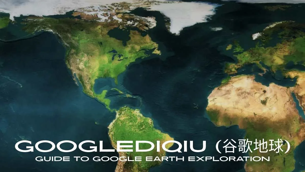
Googlediqiu (谷歌地球) is the Chinese name for Google Earth, a powerful virtual globe and mapping platform developed by Google. Since its debut in 2005, it has transformed how people see and interact with our planet. Through high-resolution satellite imagery, 3D landscapes, detailed building models, and rich geographic data, Googlediqiu enables anyone to explore almost any location from remote mountain peaks to bustling city streets right from a computer or mobile device.
Used worldwide for education, environmental research, travel planning, and general exploration, Googlediqiu offers an immersive and interactive way to navigate the world. Whether you want to stand virtually atop Mount Everest, dive into the depths of the Mariana Trench, or compare historical landscapes over decades, Google Earth makes it possible with just a few clicks.
Table of Contents
What is Googlediqiu?
In Chinese, “谷歌” (Gǔgē) means Google and “地球” (dìqiú) means Earth. Combined, 谷歌地球 refers to the same platform known globally as Google Earth. It is far more than a simple map; it is an interactive 3D model of the planet that integrates multiple datasets, including:
- Satellite and aerial imagery for realistic overhead views of landscapes and cities.
- 3D modeling to visualize mountains, buildings, and landmarks from any angle.
- Geographic Information System (GIS) layers for environmental, social, and historical insights.
- Street View for immersive, ground-level perspectives of streets and attractions.
This integration makes Googlediqiu a multi-functional platform for both casual exploration and professional use.
Key Features of Googlediqiu
High-Resolution Satellite Imagery
Zoom in to view coastlines, farmland, urban areas, and even individual vehicles or vegetation patterns. This is essential for urban planning, agriculture monitoring, and tourism research.
3D Terrain and Buildings
Explore cities like Beijing, Paris, or New York in detailed 3D, or view mountain ranges, valleys, and coastlines with lifelike depth.
Historical Imagery
Use the time slider to compare changes over years or decades, a valuable tool for studying climate change, urban growth, and historical geography.
Ocean and Space Exploration
Go beyond the land to explore ocean floors with bathymetric data, or switch to Sky Mode to view stars, constellations, and planets.
Street View Integration
Take virtual walks through cities and landmarks, experiencing places as if you were there in person.
Interactive Data Layers
Overlay real-time weather, demographic statistics, and geographic boundaries for research and analysis.
How Googlediqiu Works
Google Earth relies on a combination of satellite imagery providers, aerial photography from aircraft, and GIS datasets. These visuals are stitched together using advanced algorithms and displayed on a 3D model of the Earth.
The platform is powered by Google’s geospatial cloud technology, which processes and streams massive amounts of imagery so users can navigate smoothly without needing to download huge files. This is achieved through:
- Tiling: Breaking large images into smaller sections for faster loading.
- Caching: Storing recently viewed areas for quicker access later.
- Rendering Engines: Translating raw geospatial data into a lifelike visual experience.
The result is a seamless, responsive virtual globe accessible via desktop applications, web browsers, or mobile devices.
Applications of Googlediqiu
| Application Area | Usage | Benefits |
| Education & Research | Virtual geography lessons, landmark exploration, climate studies, archaeology, and biodiversity mapping. | Engages students, supports scientific research with visual datasets. |
| Travel & Tourism | Preview destinations, measure routes, explore hotels and surroundings, and take virtual tours. | Improves trip planning, inspires travel decisions. |
| Environmental Studies | Track deforestation, glacier retreat, urban sprawl, and wildlife habitats. | Raises awareness, aids conservation projects. |
| Urban Planning | Evaluate terrain, visualize developments, and assess infrastructure layouts in 3D. | Enhances design accuracy, reduces planning errors. |
| Disaster Management | Map affected zones, coordinate relief efforts, and assess post-disaster damage. | Improves emergency response speed and efficiency. |
Googlediqiu in the Digital Age
Googlediqiu connects cultures, disciplines, and communities. It lets students in rural China explore global landmarks, enables researchers to monitor deforestation in near real-time, helps travelers plan trips, and allows conservationists to showcase endangered habitats. Its influence extends beyond technology, fostering global awareness, cross-cultural understanding, and environmental responsibility.
Versions and Accessibility
- Google Earth Pro (Desktop): Free, with advanced tools for measurements, GIS imports, and high-resolution printing.
- Google Earth Web: Runs in a browser without installation.
- Google Earth Mobile App: Available for Android and iOS, optimized for touch navigation and location sharing.
Note: In mainland China, access to Google Earth may require a VPN or alternative connection methods.
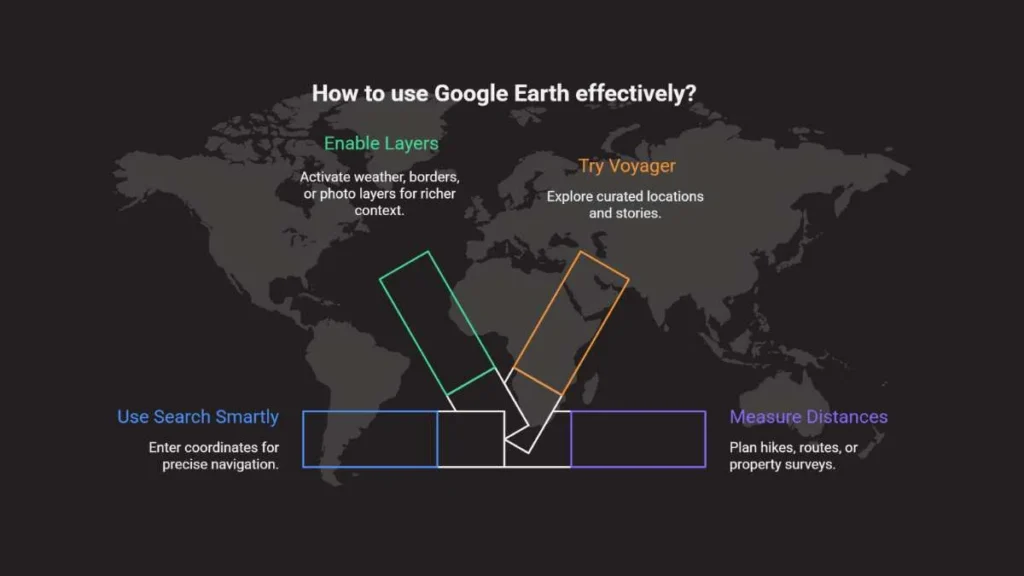
Tips for Using Googlediqiu Effectively
- Use Search Smartly: Enter coordinates for precise navigation.
- Enable Layers: Activate weather, borders, or photo layers for richer context.
- Try Voyager: Google Earth’s built-in guided tours showcase curated locations and stories.
- Measure Distances: Great for planning hikes, routes, or property surveys.
- Switch Perspectives: Alternate between satellite, 3D, and Street View for a complete understanding of a location.
Frequently Asked Questions
1. Is Googlediqiu free to use?
Yes. The desktop, web, and mobile versions are free, with advanced tools in Google Earth Pro at no extra cost.
2. How accurate is its imagery?
Accuracy depends on the source and update schedule. Cities are updated more frequently than remote regions.
3. Can I use it for commercial purposes?
Yes, but users must follow Google’s licensing and attribution policies.
Conclusion
Googlediqiu (谷歌地球) transforms how people explore and understand the world, offering a highly accessible and immersive way to connect with Earth’s landscapes, cultures, and environmental changes. By combining advanced geospatial technology with rich datasets, it fuels curiosity, supports learning, and promotes global awareness, making it one of the most influential digital tools for exploration in the modern era.

Geekzilla Podcast: Best Hub for Geek Discussions

Calibration Explained: Accurate Measurement Guide

MangaPill Explained: Free Manga Access Pros & Cons

How ins Reflects True Identity and Awareness

Snokido: Free Unblocked Online Games Play Instantly

What Is Milyom? The Emerging Digital Lifestyle & Creative Shift

NTDTVJP: Authentic Japanese News & Culture Online

GifHQ: Find, Share & Download Animated GIFs Easily

Cesta Roman: Ancient Roman Roads and Lasting Influence

Logisths: Intelligent Supply Chain Management

CDiphone Smartphone: AI, Modular Design & Creative Power

Discover Pizokeelio: Modern Digital Naming Trends

Discover Yalla Choy: Tea, Tradition & Togetherness

Epcylon Technologies Inc: Real-Time FinTech Trading Solutions

Onnilaina Online Loans: Fast, Secure & User-Friendly

Pasonet: Fast & Secure Digital Payment Gateway Solution

Musté: Embrace Pure, Authentic, and Untouched Originality

Shani Levni: Innovative Art and Storytelling Vision

Lifestyle & Fashion Trends: Express Your True Identity

Instablu: Authentic Visual Storytelling Social Platform
-

 FRIENDSHIP MESSAGES6 months ago
100+ Heart Touching Sorry Messages for Friends
-

 ANNIVERSARY WISHES9 months ago
100+ Beautiful Engagement Anniversary Wishes Messages and Quotes
-

 BIRTHDAY WISHES9 months ago
300+ Happy Birthday Wishes for Brother | Heart Touching Happy Birthday Brother
-

 FRIENDSHIP MESSAGES6 months ago
80+ Emotional Friendship Messages & Quotes